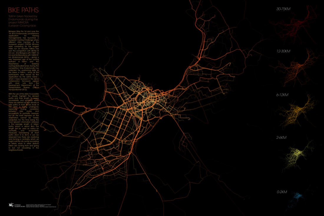
Bike Paths — Tallinn (2012)
Before SPIN Unit existed as a company, this project asked a question that would define its later practice: can you read a city’s real structure — not its administrative boundaries, but how people actually move through it — directly from movement data? This was one of the first times that question was asked using consumer GPS data in Tallinn.
In May 2012, Tallinn took part in the first European Cycling Challenge, an EU-funded CIVITAS MIMOSA initiative run through the Endomondo fitness app, pitting five European cities (Tallinn, Gdańsk, Utrecht, Bologna, Funchal) against each other for the longest total distance cycled in a month. Tallinn won decisively. Because participants were grouped under a shared city account, Damiano Cerrone — then a Master’s student at the Estonian Academy of Arts (EKA) — was able to obtain the full anonymised GPS dataset for Tallinn’s riders, working with Liivar Luts of the city’s Transport Department. The resulting maps became part of his MA thesis, “Tallinn: Opening the City to the Seaside,” supervised by Prof. Panu Lehtovuori.
GPS tracklogs from the competition were mapped and colour-coded into five trip-length bands (0–2km through 30–75km) across Tallinn’s street network, using path density as a proxy for accessibility and centrality — an early, hands-on application of the space-syntax thinking that would recur throughout SPIN Unit’s later work.
A self-directed research project built on a real-world data opportunity, produced as a set of large-format analytical panels for academic submission.
Open full size ↗