← All projects/Mobility/No. 41
2021 · Mobility · Fyma

Mobility KPIs for Queen Elizabeth Olympic Park

Turning live CCTV computer-vision data into planning-grade mobility KPIs for London’s Olympic Park — a genuine two-way R&D collaboration that fed improvements back into the sensor company’s own product.
Mobility KPIs for Queen Elizabeth Olympic Park

Planning authorities usually build mobility KPIs from expensive, one-off surveys. Fyma’s computer-vision platform, reading existing CCTV feeds without storing video, offered something different: continuous, GDPR-compliant traffic data — if someone could turn it into planning-relevant metrics.

A research collaboration between SPIN Unit and Fyma, delivered for the London Legacy Development Corporation, the planning authority for Queen Elizabeth Olympic Park, running through two phases in summer and winter 2021.

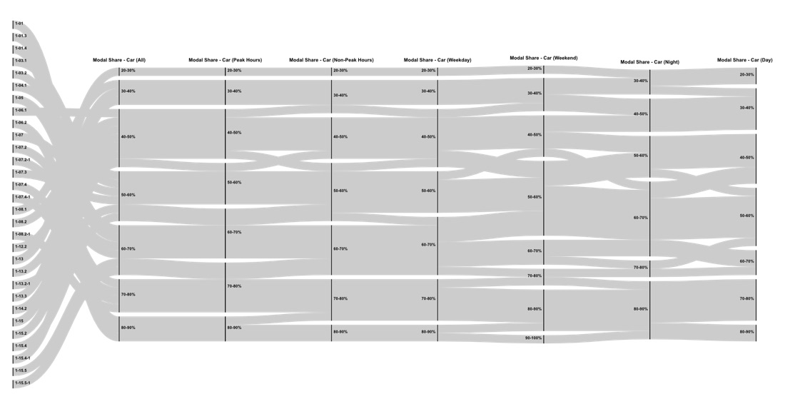
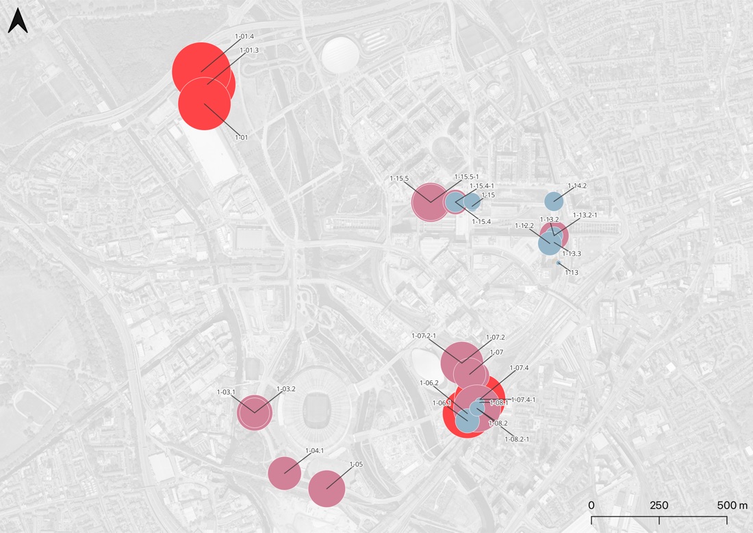
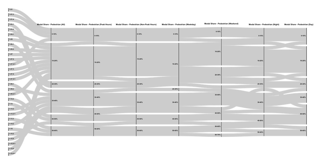
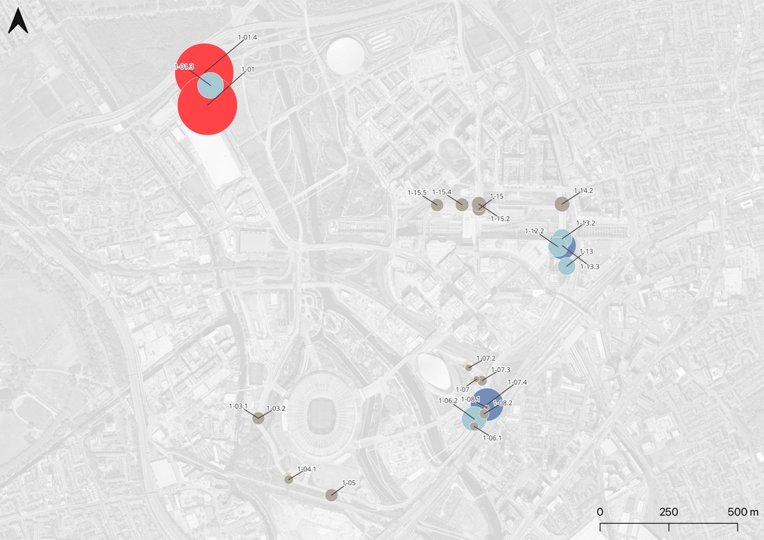
Designed a suite of mobility indexes computable directly from Fyma’s ~30-camera network — traffic density, modal share, modal consistency, amenity diversity and popularity — applied across five clusters around the park (Trampery, Stratford International, Westfield Stratford City, the Aquatics Centre, the Stadium).

Delivered a summer analysis and report (August 2021) followed by a winter update (December 2021), alongside a set of concrete suggestions for improving Fyma’s own sensing platform for urban-planning use cases.
1 report to download
About the project
ClientFyma
PlaceQueen Elizabeth Olympic Park, London, UK
Year2021
LensMobility
TopicsComputer Vision, Mobility KPIs, Product R&D
What we found
Vehicles accounted for 67.7% of all observed traffic across the study area, reaching up to 90% car modal share on weekends in the Trampery area — already at capacity during peak hours.
Westfield Stratford City was the one clear exception, where walking consistently outranked driving — correlating directly with that area’s higher mix of necessary and optional amenities.
Despite high-quality cycling infrastructure, bicycle modal share peaked at only around 8% — the report specifically recommended better east-west cycle connectivity to link the park’s internal network to central London routes.
Used the same granular camera data to study traffic on a school access road, finding measurable shifts in mode share tied to the school calendar — a concrete road-safety planning input.
The engagement fed back into Fyma’s own product: SPIN Unit proposed specific technical improvements (like treating pedestrian crossings as measurable micro-zones) rather than just consuming the platform’s output.
Pictures

More mobility projects

All 61 →
Mobility
City of Tallinn
2021
SPIN Unit · Helsinki — Tallinn
Project record No. 42
Lens:
Mobility
Reports:
1
Kiida Peatust / Laida Peatust — Crowdsourced Bus Stop Survey
SPIN UnitRead the record →
Mobility
Association of Municipalities of Harju County
2021
SPIN Unit · Helsinki — Tallinn
Project record No. 43
Lens:
Mobility
Reports:
1
The New Modal — Mobility Equity in Harju County
SPIN UnitRead the record →
Mobility
City of Tallinn
2020
SPIN Unit · Helsinki — Tallinn
Project record No. 38
Lens:
Mobility
Reports:
1
metaYLE — Ülemiste Mobility Nudge
SPIN UnitRead the record →
Mobility
Demos Helsinki
2020
SPIN Unit · Helsinki — Tallinn
Project record No. 33
Lens:
Mobility
Reports:
—
Riga Mobility Metrics
SPIN UnitRead the record →
Mobility
City of Tallinn
2019
SPIN Unit · Helsinki — Tallinn
Project record No. 30
Lens:
Mobility
Reports:
4
metaPARK — Performance-Based Parking Policy for Tallinn
SPIN UnitRead the record →