Moscow Green & Water Accessibility Analysis
Strelka KB needed a citywide picture of how well Moscow’s green spaces and waterways actually serve residents on foot — part of a wider plan to raise standards for recreational infrastructure. When their draft methodology proved undeliverable and the in-house team lacked GIS capacity, SPIN Unit stepped in twice: first to fix the plan, then to build it.
Commissioned as outside expert support for Strelka KB’s multi-volume study “The development of the recreation and tourism industry in 2012–2018.” SPIN Unit’s first visit reviewed the client’s draft methodology and found it implied 153 analytical outputs in a 20-working-day window — practically impossible — and proposed a workable 15-output restructuring instead. A second visit followed when the client’s team hadn’t completed the underlying data prep or analysis.
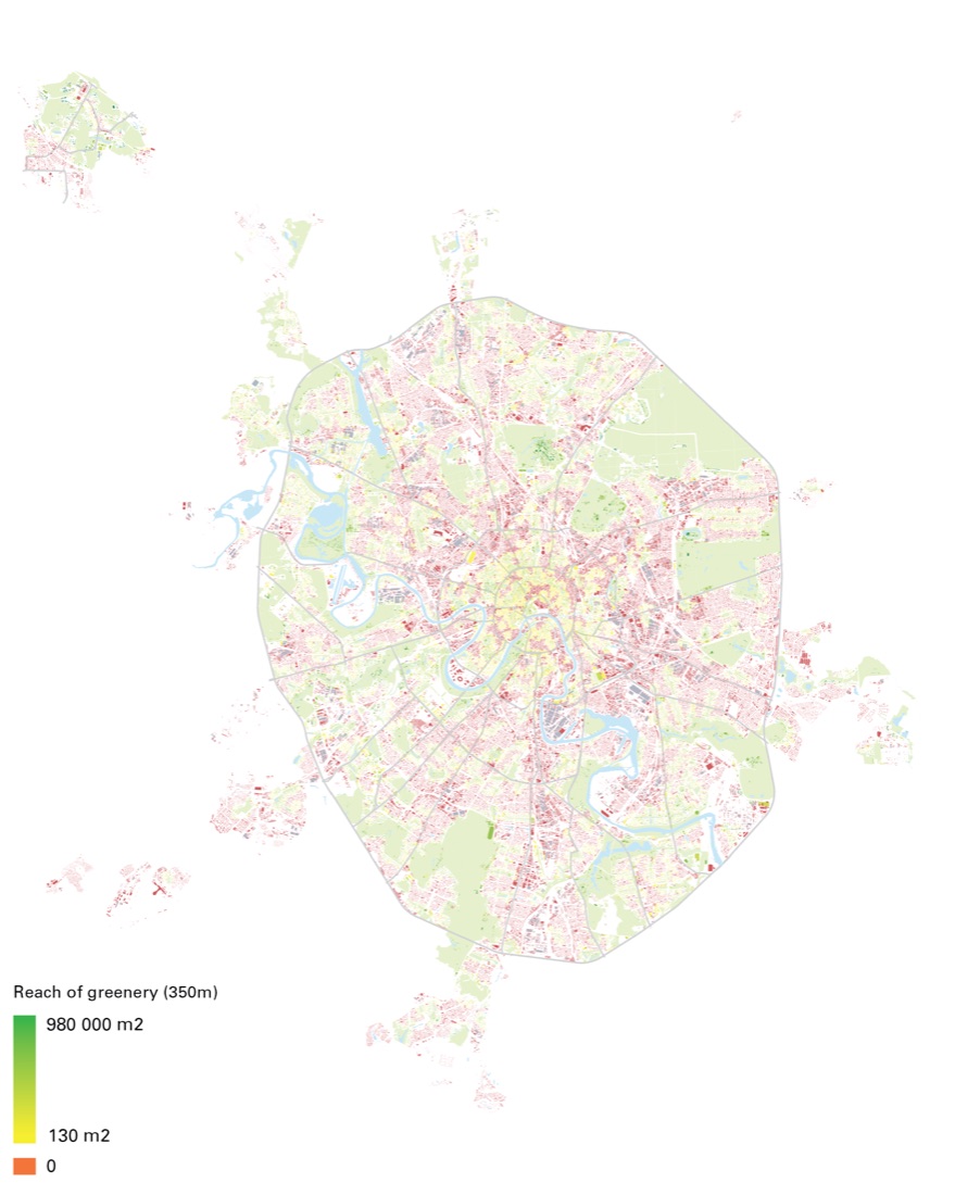
Reach index (developed with Raul Kalvo, via a custom Rhino↔QGIS tool) measured accessible green and water area per building within 350–800m of real walking distance. Betweenness centrality between homes and transit stops served as a proxy for pedestrian flow, since no mobile-positioning data was available. Google Places and Instagram data mapped where recreational activity actually concentrates.
Two consulting visits in mid-2016: a methodology review and knowledge-transfer workshop, followed by direct production of the missing Reach and Betweenness analyses and final maps when the client’s own team could not complete the work in time.
 Open full size ↗